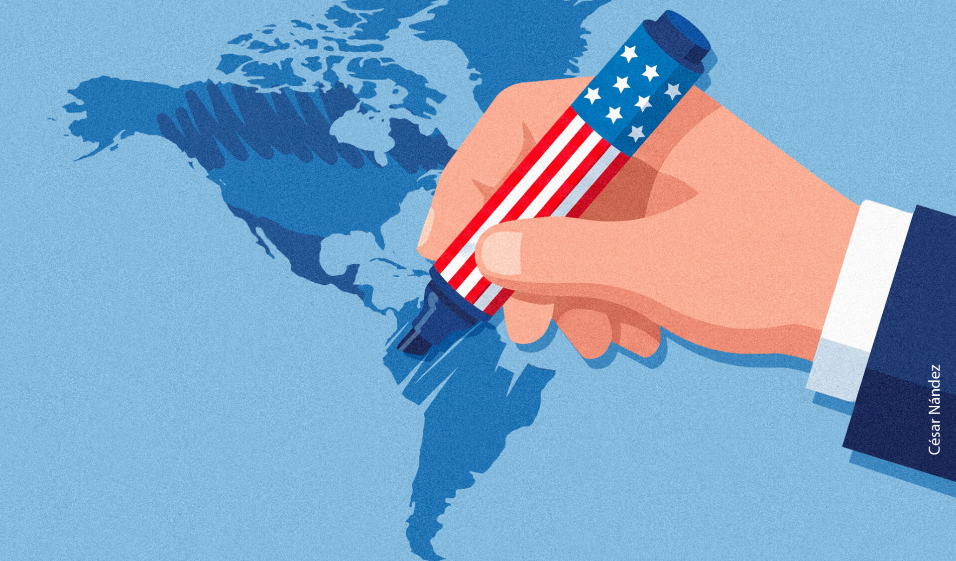
Donald Trump posted a map without writing a single word. He did not need to: the flag of the United States covered Mexico, Canada, Greenland, Iceland, and much of the Caribbean. Across that expanse appeared a single name: United States of America.
The origin of the image is unclear. Trump routinely shares memes and content created by his followers or generated through artificial intelligence on the social network Truth Social. But it was he who chose to place that map before millions of people.

The post did not appear in isolation either. In 2025, Trump ordered the U.S. federal government to call the Gulf of Mexico the “Gulf of America.” In August 2026, he renamed Lake Ontario “Lake America.” Shortly afterward, he suggested changing the name of the state of New Mexico to “New America.” The map came at the end of that sequence, extending his country’s flag over much of its neighbors. First, he changed the names. Then, he showed the territories as his own.
For Latin America, that image is not a distant provocation. Mexico, Central America, and the Caribbean appear absorbed under a foreign flag. There are no arguments, treaties, or legal claims. The map simply presents them as if their sovereignty had disappeared. Without expressly referring to Trump’s post, Mexican President Claudia Sheinbaum said that same day that Mexico “is not and will not be a colony or protectorate of any foreign country.”
The new names do not alter international law or oblige other countries to recognize them. However, their circulation is not limited to U.S. government documents. Google Maps displays “Gulf of America” and “Lake America” to users accessing the platform from the United States. Mexico retains “Gulf of Mexico”; Canada, “Lake Ontario.” In other countries, both names may appear. The result is that users in the United States, Canada, and other countries can look up the same place and find different names.
Google explains that it follows official sources recognized in each country. It is a policy designed to handle names that vary across jurisdictions, but it has broader consequences. When a name decreed by a government appears on the screens of millions of people, it becomes part of the everyday landscape. In this way, a political decision takes on the appearance of geographical information. The map we assumed was shared fragments into national versions of the world.
As Trump circulated that image, the United Nations (UN) General Assembly had just approved a resolution on another way of changing maps. With 164 votes in favor, one against, and six abstentions, the UN promoted the use of equal-area projections, capable of representing the relative size of territories more accurately. The United States cast the only vote against it.
The resolution favors alternatives such as Equal Earth, a projection created in 2018 that preserves the proportions between areas and seeks to maintain recognizable continental shapes. Over time, the classic Mercator projection became one of the world’s most familiar images. Designed in 1569 to facilitate navigation, it made it possible to plot courses on a flat surface. In exchange, it progressively enlarged territories as they moved farther from the equator. Greenland ended up appearing almost as large as Africa, even though Africa is about fourteen times larger.
Thus, a tool conceived for navigating the seas became the map through which entire generations learned to imagine the planet. Europe, Canada, and Greenland acquired disproportionate dimensions. Africa, much of Latin America, and South Asia were visually diminished in comparison with territories at higher latitudes. The distortion did not create international hierarchies on its own, but it gave them an image. The most powerful territories also appeared to be naturally larger.
The criticism of Mercator dates back several decades. Toward the end of the 20th century, the Peters map, another equal-area projection, became more widely known. The contrast revealed an Africa and a South America far larger than traditional maps suggested. Peters preserved areas, although it considerably distorted shapes. Equal Earth takes up the same principle with a more balanced design.
If it reaches schools, the new projection may change some notions learned from childhood. Among other things, it will show that the United States could fit into Africa about three times, that Brazil is much closer in size to Canada than traditional maps suggested, and that South America is considerably larger than Europe. The territories will continue to measure the same, but the intuition learned from childhood about which countries are large, where the center lies, and which regions appear on the margins will change.
Peruvian sociologist Aníbal Quijano used the concept of the coloniality of power to explain the persistence of hierarchies born during colonialism, even after the formal disappearance of empires. That hierarchy also shaped the production of knowledge: perspectives originating in the Global North ultimately came to be presented as the universal way of interpreting reality.
Although it will not repair centuries of inequality or increase Latin America’s economic or political influence, correcting the map can be understood as a form of cognitive justice. It can change the position from which Latin Americans learn to see ourselves within it, and prevent us from confusing the size of power with the size of territory.
Every projection requires choosing which quality to preserve and which to distort. Mercator sacrificed areas in order to preserve directions. Equal Earth preserves areas at the cost of distorting, to varying degrees, shapes, distances, and directions. Trump’s map distorts something that does not depend on mathematics: sovereignty.
In the 16th century, a projection could shape the perception of the size of continents for generations. In the 21st century, a government can change a name and a global platform can display it within days to millions of eyes.
That is why the question is no longer simply who possesses a territory, but who has the power to name it and draw it, and to make others grow accustomed to seeing it in a particular way. Because before moving borders, power usually begins with names.
Autor

Writer and consultant in political and institutional communication. He analyzes politics, society, and mobility dynamics in Latin America, with an emphasis on their institutional implications and the construction of political community.